![]()
1909 Glyndon Township Plat Map
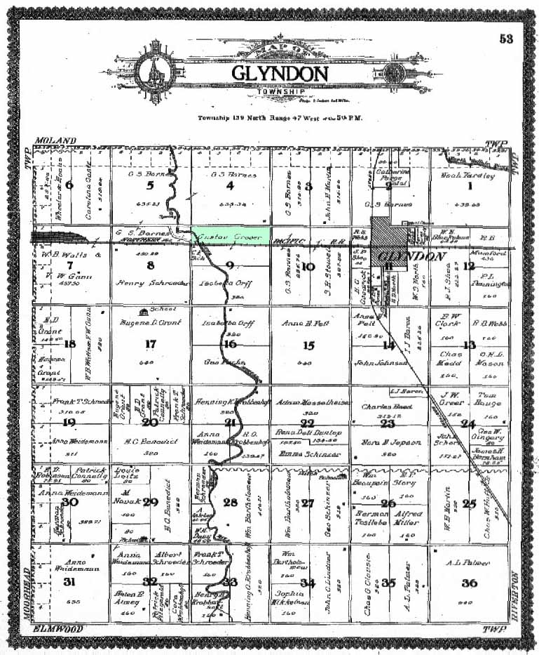
Click on the map and a larger image will display in a new window
Gustav's farm was located in the northern quarter of section 9, bordered on the north by present day US Highway 10 and on the south by the railroad tracks. The northern edge of Section 4 (directly north of section 9) borders section 33 in Moland township.
Click Here for the 1909 Plat Map of Moland Township
![]()
An "unedited" high definition plat map of Glyndon township in 1909 is available on the Historical & Cultural Society of Clay County's website. |
|
Return to |
Farm Photo |
![]()
![]()
![]()
![]()
|
Copyright 1998-2019 Tarje Grover Family |
![]()